
Communities of Lake Nona, Orlando
Graphic Design | Mapping
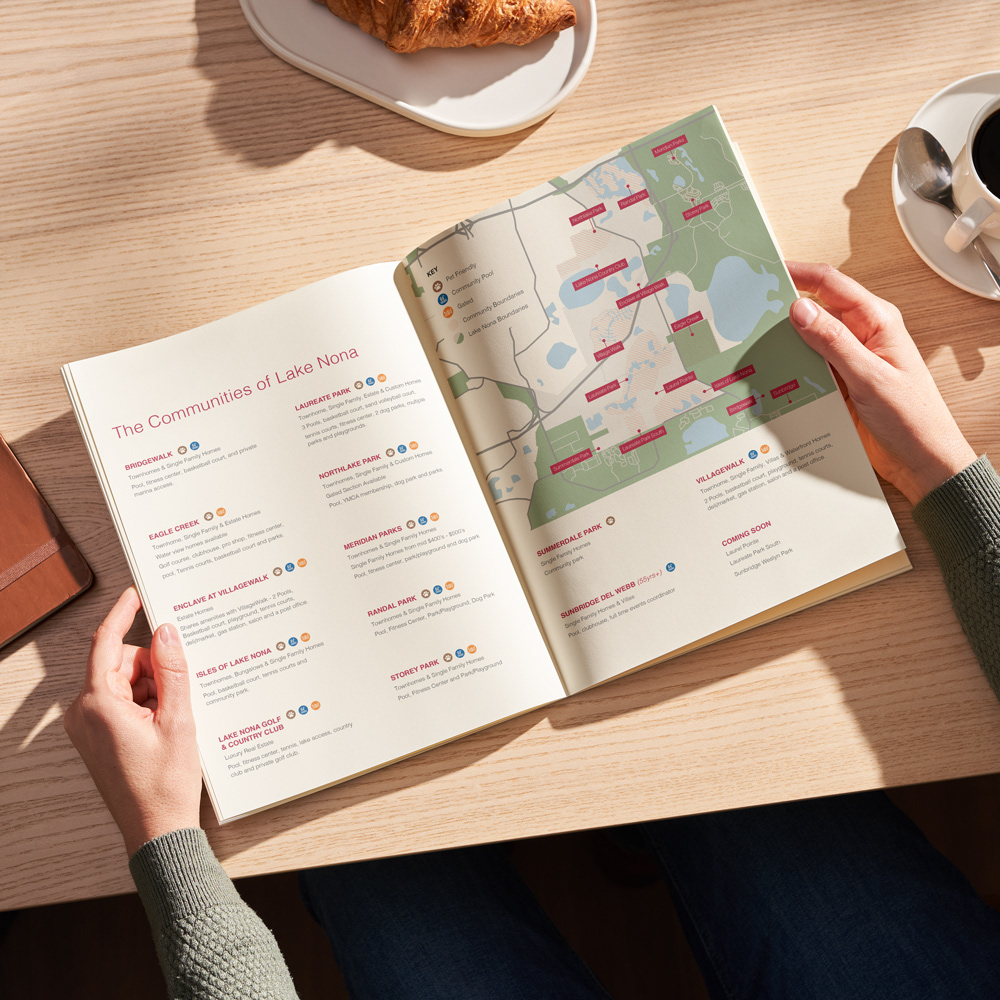
Overview: Lake Nona is a newer master-planned community-based in Orlando, Florida, near the Orlando International Airport, and they focus on technology, innovation, and community.
Challenge: The area is expanding quickly with new communities and businesses. Because of this boom, locating information on neighborhoods like building types, price points, amenities, and even location can be hard to find.
Goal: Take all the data and create a simple spread that answers our client's main concerns when researching neighborhoods in the Lake Nona area.
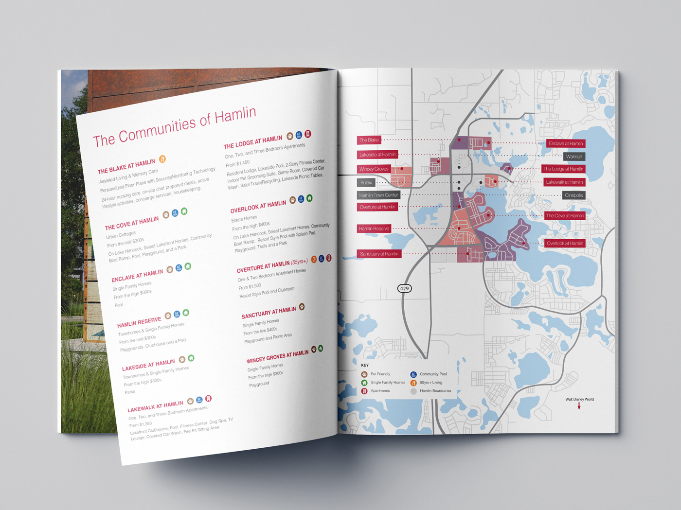
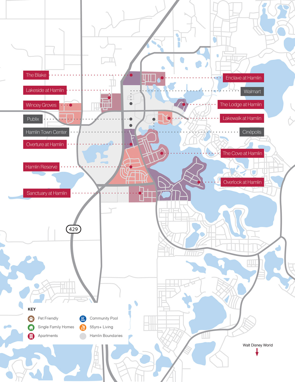
Communities of Hamlin, Winter Garden
Graphic Design | Mapping
Overview: Hamlin, based in Winter Garden, Florida is one of the fastest-growing master-planned communities in the U.S. Located within the shadows of Walt Disney World, there's a quiet break from Orlando while only being minutes away from all the best activities that Central Florida has. The area has a live, work, play mentality where the focus is on building strong community bonds by building infrastructure and hosting in-person events.
Challenge: With the area growing so quickly relevant up-to-date information on all the communities in the area can be a hassle to find.
Goal: This community map was a way to pull all of the relevant information that clients would need to make decisions on the neighborhoods they are most interested in based on their lifestyle and needs.
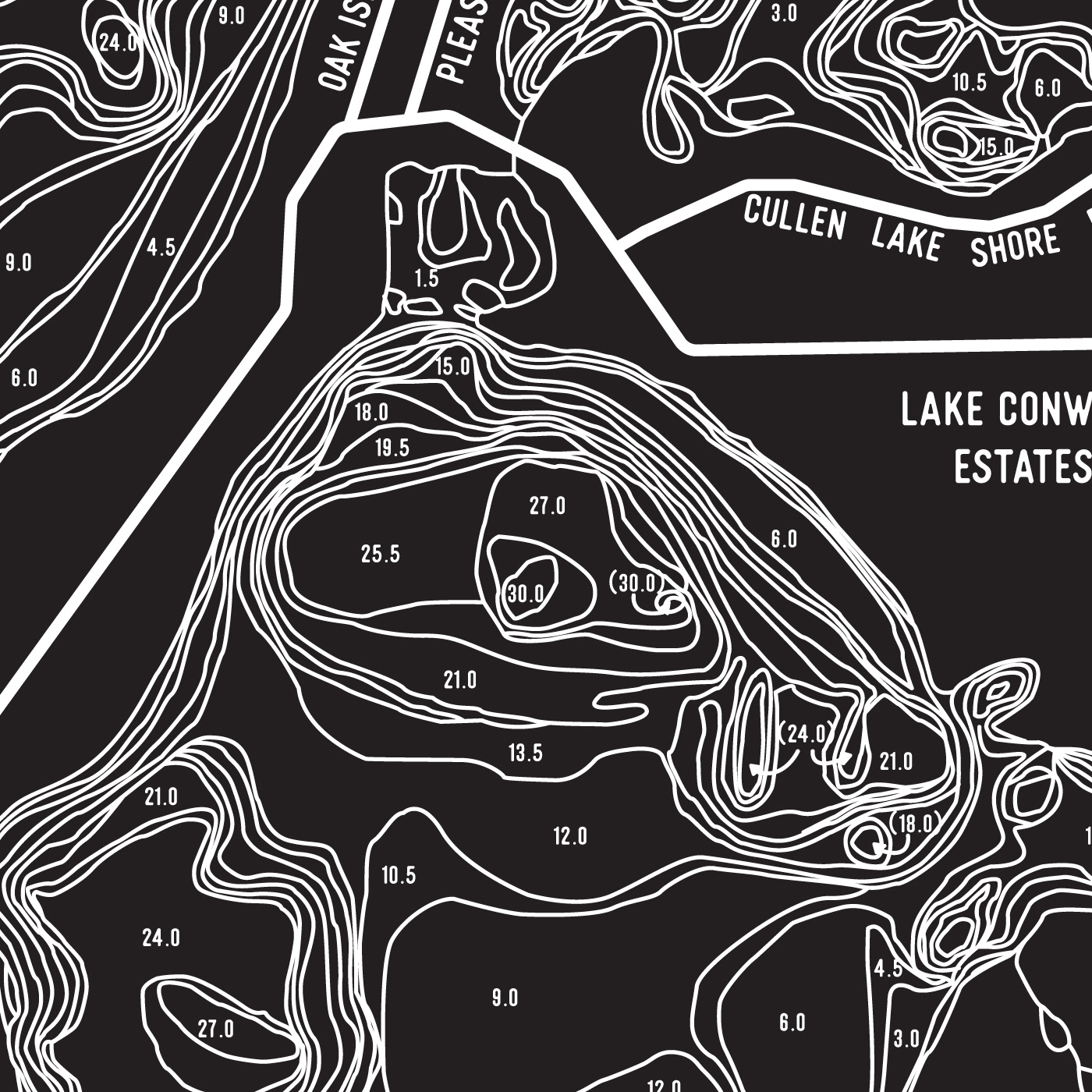
Zoom in on map details
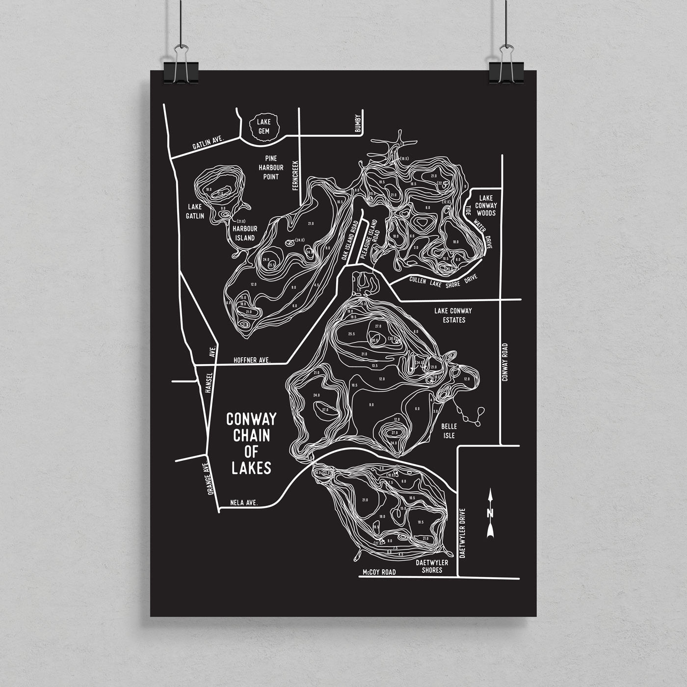
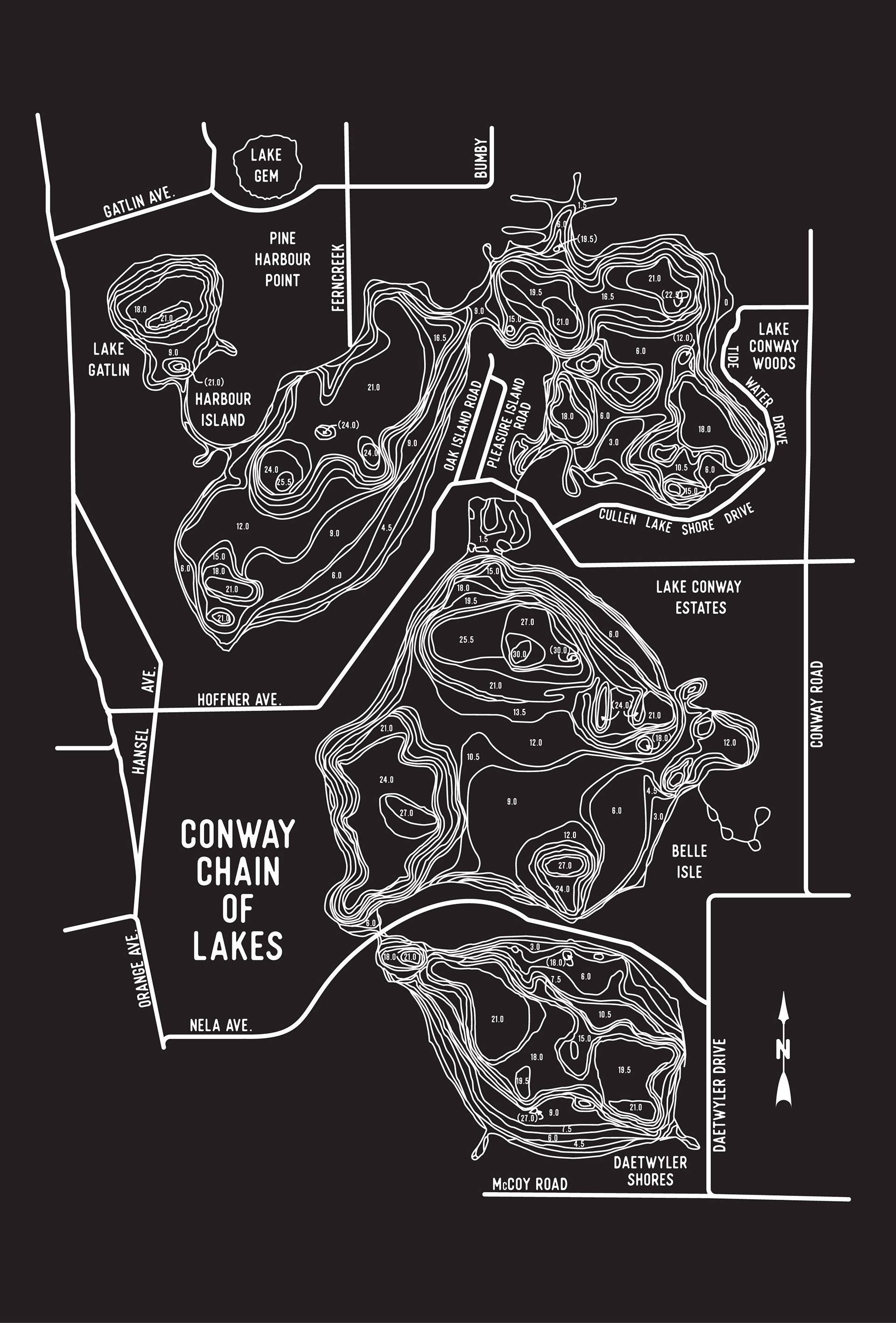
Conway Chain of Lakes Topographic Map
Graphic Design | Mapping
Overview: The Conway Chain of Lakes is a world-renowned set of interconnected lakes and water pools located about 6 miles south of Downtown Orlando. Fishing is one of the most popular activities on the chain, but you will also see water sports like water skiing, kayaking, and canoeing.
Challenge: A boat dealer came to me with an old topographic map poster of the chain of lakes that had been in their office for years. They had no original design files of the poster and were working on a tight budget, so we couldn't get it professionally scanned by a local printer. We resorted to having someone hold up the poster and capture a photo with our phone.
Goal: Recreate the entire map inside of Adobe Illustrator to go on any marketing material. The finished design was printed on 18x24 posters and used as a giveaway item when clients purchased a boat from the dealer.
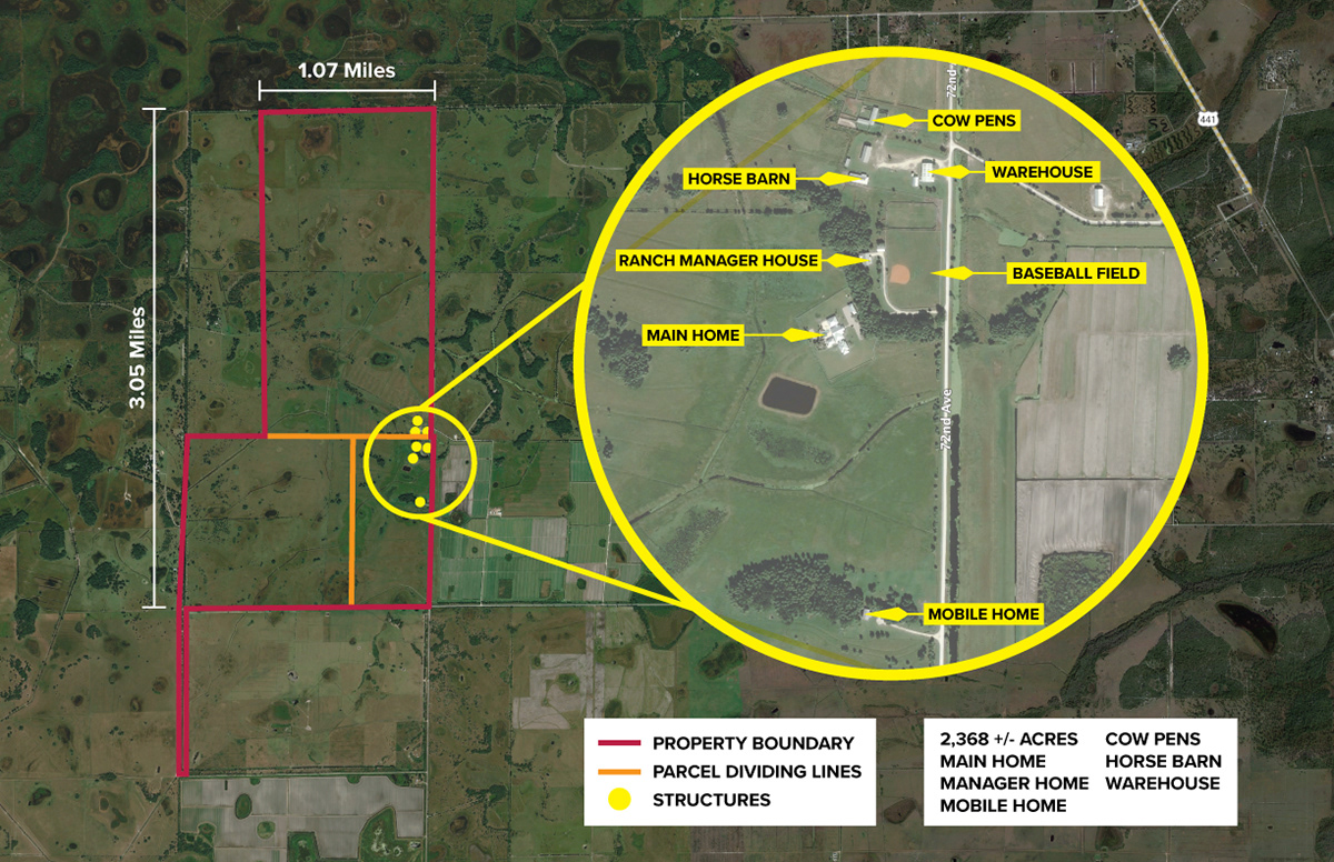
Victoria's Ranch - Micro View
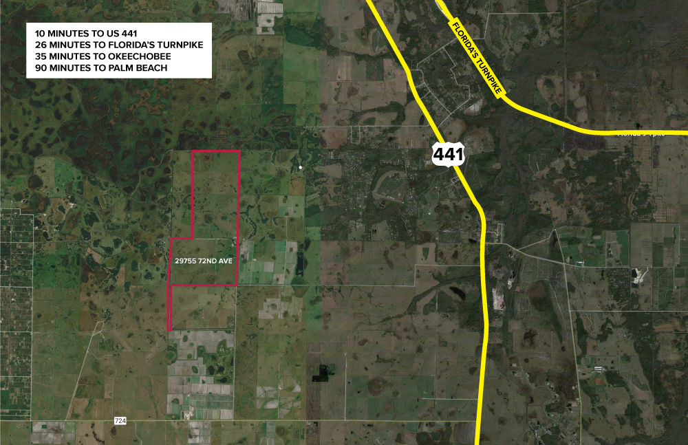
Victoria's Ranch - Macro View
Victoria's Ranch Property Outlines and Structures
Graphic Design | Mapping
Overview: Victoria's Ranch is a 2,368-acre working cattle ranch in Okeechobee, Florida listed for sale. The property consists of multiple structures, 14 pastures, and a full-size baseball field.
Challenge: The real estate agent wanted a map outlining the whole 2,000+ acre property while also calling out the individual structures that all seemed to sit in a small portion of the ranch, making graphics impossible to fit.
Goal: Create a clear, easily digestible map using high-resolution satellite imagery from Google Earth to properly outline the property, its dividing lines, and structures all in one document.

